 ENEON past events
37th International Symposium on Remote Sensing of Environment (ISRSE-37) - GEO In-Situ Observation Networks
DATES: Tshwane | South Africa | 11st May 2017
VENUE: 15:30-17:00 Room: Crystal Room (Level +1)
GEO-XIII Plenary - In-situ EO networks and its relation to GEOSS (ENEON)
DATES: St. Petersburg | Russia | 7th November 2016
VENUE: 09:00-10:30 Room: Green 7
AGENDA:
09:00-09:10: Welcome and agenda (Joan Masó, CREAF)
09:10-09:25: GD-06 report and conclusions (Hans-Peter Plag, Tiwah)
09:25-09:40: In situ activities of IAG and GGOS (Günter Stangl, ÖAW)
09:40-09:50: ENEON and its contributions to GEO (Ian McCallum, IIASA)
09:50-09:55: Contribution example: Mapping the Network Landscape (Ivette Serral, CREAF)
09:55-10:05: Contribution example: Meta network in solar energy (Lionel Menard)
10:05-10:10: Contribution example: Industry involvement (Geoff Sawyer, EARSC)
10:10-10:15: Contribution example: ENEON Commons concept paper (Joan Masó, CREAF)
10:15-10:30: Open discussion: The Foundational Task "GEOSS in-situ Earth observation resources" structure in view of the ENEON continuity plans. (Moderated by Hans-Peter Plag, Tiwah and Joan Masó, CREAF)
MORE INFO: https://www.earthobservations.org/geo13.php
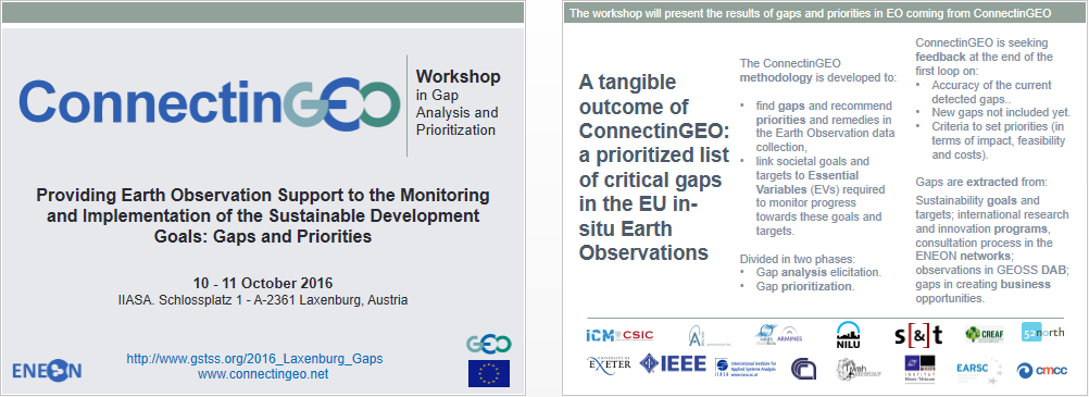
Earth Observation gaps and prioritization actions' Workshop
DATES: Laxenburg | Austria | 10 afternoon – 11 October all day 2016
VENUE: IIASA (Schlossplatz 1 - A-2361 Laxenburg, Austria)
----------------------------------------------------------
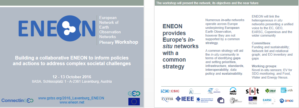
ENEON Plenary Workshop
DATES: Laxenburg | Austria | 12 all day – 13 October morning 2016
VENUE: IIASA (Schlossplatz 1 - A-2361 Laxenburg, Austria)
First ECSA Conference 2016. Citizen Science – Innovation in Open Science, Society and Policy
DATES: Berlin | Germany | 19–21 May 2016
VENUE: Kulturbrauerei
MORE INFORMATION: http://www.ecsa2016.eu/
PROGRAMME:

----------------------------------------------------------
 General Assembly 2016
General Assembly 2016 DATES: Vienna | Austria | 17–22 April 2016
VENUE: Austria Center Vienna
ESSI2.7 - The Networks of Earth Observation, its coordination and their infrastructures to enhance international geoscience information access, provision and use
Convener: Joan Masó
Co-Conveners: Ivette Serral , Ian McCallum , Jay Pearlman
Different observation networks are providing important datasets for different geosciencies. Examples are EMSO, ARGOS, ICOS, EPOS, LTER, ACTRIS, SeaDataNET, Interact, EuroArgo, EISCAT, SIOS, EuroGOOS, etc. This session presents the efforts to provide create and consolidate sensor network, the infrastructure and the data made available to scientist. In addition, it presents efforts to harmonize and coordinate the Network of Networks at the European level. It also addresses not covered data user needs and gaps in the current data and infrastructures and suggests remedies.
In addition, this session is to provide a forum to advance collaboration, and facilitate exchange of methods and ideas between those working in different disciplines to discuss the integration and harmonisation of geoscience information and services to inform ongoing European and global initiatives. There are also links to existing and developing Infrastructures and research infrastructures (such as the pan-European Geological Data Infrastructure [EGDI]). In this context international examples are encouraged so best practice and experience can be shared including for example the implementation of INSPIRE specifications. Many of the end-users of geoinformation and services are not from the geoscience domain or are non-scientists so we also encourage papers from other domains and those with real requirements from the geoscience community.
Orals (Fri, 22 Apr, 10:30–12:00 / Room 2.61): http://meetingorganizer.copernicus.org/EGU2016/orals/21821
11:00–11:15. EGU2016-16692. Current status of the Essential Variables as an instrument to assess the Earth Observation Networks in Europe. Palma Blonda, Joan Maso, Antonio Bombelli, Hans Peter Plag, Ian McCallum, Ivette Serral, and Stefano Stefano Nativi
11:15–11:30. EGU2016-12647. Sensor Web Standards for Interoperability between in-situ Earth Observation Networks. Matthes Rieke, Raquel Casas, Oscar Garcia, Simon Jirka, Lionel Menard, Thierry Ranchin, Christoph Stasch, and Lucien Wald
Posters (Attendance Fri, 22 Apr, 17:30–19:00 / Hall A): http://meetingorganizer.copernicus.org/EGU2016/posters/21821
EGU2016-8294. Topology of the European Network of Earth Observation Networks and the need for an European Network of Networks. Joan Masó, Ivette Serral, Ian McCallum, Palma Blonda, and Hans-Peter Plag
EGU2016-16925. Gap analysis of the European Earth Observation Networks. Guillem Closa, Ivette Serral, and Joan Maso
SMI32 - ENEON FWEN.WG: Earth Observation in support of the Food-Water-Energy Nexus (by invitation only)
Convener: Hans-Peter Plag
Date: Thu, 21 Apr, 15:30–17:00 / Room 2.97
The Working Group on the Food-Water-Energy Nexus (FWEN.WG) of the European Network of Earth Observation Networks (ENEON) will meet to discuss the work for 2016.
SMI24 - ConnectinGEO: Coordinating an Observation Network of Networks EnCompassing saTellite and IN-situ (by invitation only)
Convener: Joan Masó
Date: Thu, 21 Apr, 17:30–19:00 / Room 2.42
This is a progress meeting of the project that includes and advisory board by invitation.
ConnectinGEO’s primary goal is to link existing coordinated Earth Observation networks with science and technology (S&T) communities, the industry sector and the GEOSS and Copernicus stakeholders. The aim is to facilitate a broader and more accessible knowledge base to support the needs of the GEO Societal Benefit Areas (SBAs) and their users. A broad range of subjects from climate, natural resources and raw materials, to the emerging UN Sustainable Development Goals (SDGs) will be addressed. A tangible outcome of the project will be a prioritized list of critical gaps within the European Union in observations and the models that translate observations into practice-relevant knowledge. The prioritized list will include the research activities required to address these gaps. Ultimately, this will increase coherency of European observation networks, increase the use of Earth observations for assessments and forecasts and inform the planning for future observation systems thro
ConnectinGEO has 4 major objectives:
a) Enable a European Network of Earth Observation Networks (ENEON) including space-based, airborne and in-situ observations networks.
b) Provide a methodology to convert the knowledge needs into a coherent observation and measurement compendium for ENEON strategy and development.
c) Apply the ConnectinGEO methodology to identify and assess the priority of gaps.
d) Open the results of the project and exploit them beyond the project end.
----------------------------------------------------------
ENEON & ConnectinGEO participation in the GEO-XII Plenary
Side event: Recently formed European Network of EO Networks (ENEON) as a new GEO Initiative
DATES: Mexico DF | Mexico | 10 November 2015, 16h30-18h00
VENUE: Hilton Reforma, Mexico DF. SRE: Room Genaro Estrada. Open meeting
The European Network of EO Networks (ENEON) gathers the most relevant EO networks in Europe into a comprehensive network. It is a forum for optimizing the resources and to help secure the continuity of EO projects. The session will present the mission, goals, objectives and exact purpose of the network. Will present the current membership and invite others to join. ConnectinGEO is promoting the creation of the network and is looking for its future sustainability. In GEO, ENEON can be useful to monitor the gaps and redundancies in EO and thus guide funding agencies to the main priorities to cover those gaps. The final aim is to have a complete set of EO measures (covering the right Essential Variables) that assess the achievements of the proposed UN Sustainable Development Goals. ENEON has been established by the H2020 project, ConnectinGEO, and it is supported by the EC and contributed to the GEOSS Work Plan as a GEO Initiative.
Agenda
Time |
Activity |
16:30-16:40 |
Welcome, ConnectinGEO introduction and event overview (Joan Masó, CREAF) |
16:40-16:50 |
ENEON Network and needs (Joan Masó, CREAF) |
16:50-17:05 |
Increase the exploitation of GEOSS data (Michel Schouppe, European Commission) |
17:05-17:20 |
Energy-Water-Agriculture Nexus in ENEON (Hans-Peter Plag, Tiwah) |
17:20-17:35 |
Links with private sector (Geoff Sawyer, EARSC) |
17:35-17:45 |
ENEON proposed structure and contribution to GEOSS (Hans-Peter Plag, Tiwah) |
17:45-18:00 |
Relation to the GEOSS work program and wrap-up (open discussion) |
MORE INFORMATION: https://www.earthobservations.org/me_sevent.php?seid=435
ConnectinGEO in the AIP-8 side event
DATES: Mexico DF | Mexico | 9 November 2015, 09h00-10h30
VENUE: Hilton Reforma, Mexico DF. SRE: Room Lázaro Cárdenas
AIP-8 participants will show and demonstrate the piloting activities they conducted to advance the overall interoperability capabilities of the GEOSS Common Infrastructure. The demos will be both technical and thematically oriented (SBA).
MORE INFORMATION: https://www.earthobservations.org/me_sevent.php?seid=423
ConnectinGEO in GEOBON side event
DATES: Mexico DF | Mexico | 10 November 2015, 09h00-18h00
VENUE: Hilton Reforma, Mexico DF. Hilton: Room Dona Sol
The major aim of the side event is to engage the GEO community and, in particular, the GEO principals, with GEO BON activities. The GEO BON network will present many of its flagship products at this side even. The side event will also launch the first implementation of BON in a Box and will present the open call for EBVs development. There will also be a dedicated slot to the presentation of the regional BONs. Finally, the side event will provide an opportunity to discuss future goals and opportunities for GEO BON and further linkages with the other GEO SBAs.
ConnectinGEO: The wider EV perspective in GEO (Joan Masó)
MORE INFORMATION: https://www.earthobservations.org/me_sevent.php?seid=438
ConnectinGEO in the "Non space based observation coordination" event
DATES: Mexico DF | Mexico | 10 November 2015, 09h00-18h00
VENUE: Ministry of Foreign Affairs, Mexico DF. Room Rosario Green
Background: Non space-based observing systems (including both non space-based and remote sensing airborne, land and ocean-based systems) are global and diverse and there is no global group responsible for their coordination. Up to now, non space-based coordination for GEOSS has been included in the GEO Infrastructure (IN-01) task, “Earth Observations”. This task includes both the space and non space-based communities and observation coordination. As we move to the future, this task will be reformulated to separate space and non space-based coordination in the new GEO Foundational Task plan. It is believed this approach will allow the non space-based community to become more organized, focused and achieve greater success while allowing the space community (CEOS) to focus its efforts on the expanding amount of space-based measurements.
Objectives: In order to enhance progress in the non space-based community, CEOS has agreed to work with GEO to develop a detailed task plan for the non space-based foundational task (GD6, GEOSS non Space-based Earth Observation Resources) and complete a report to define the state of global non space-based coordination and recommendations for the future. It is expected that one of the GEO Participating Organizations will agree to manage this task in the future and will utilize the work of this small task team to define its path.
ConnectinGEO: Non space based observation coordination: Towards a European Network of Earth Observation Networks (ENEON): Addressing Challenges and Facilitating Collaboration for non-space based Earth Observations Networks (Joan Masó)
MORE INFORMATION: https://www.earthobservations.org/me_sevent.php?seid=436
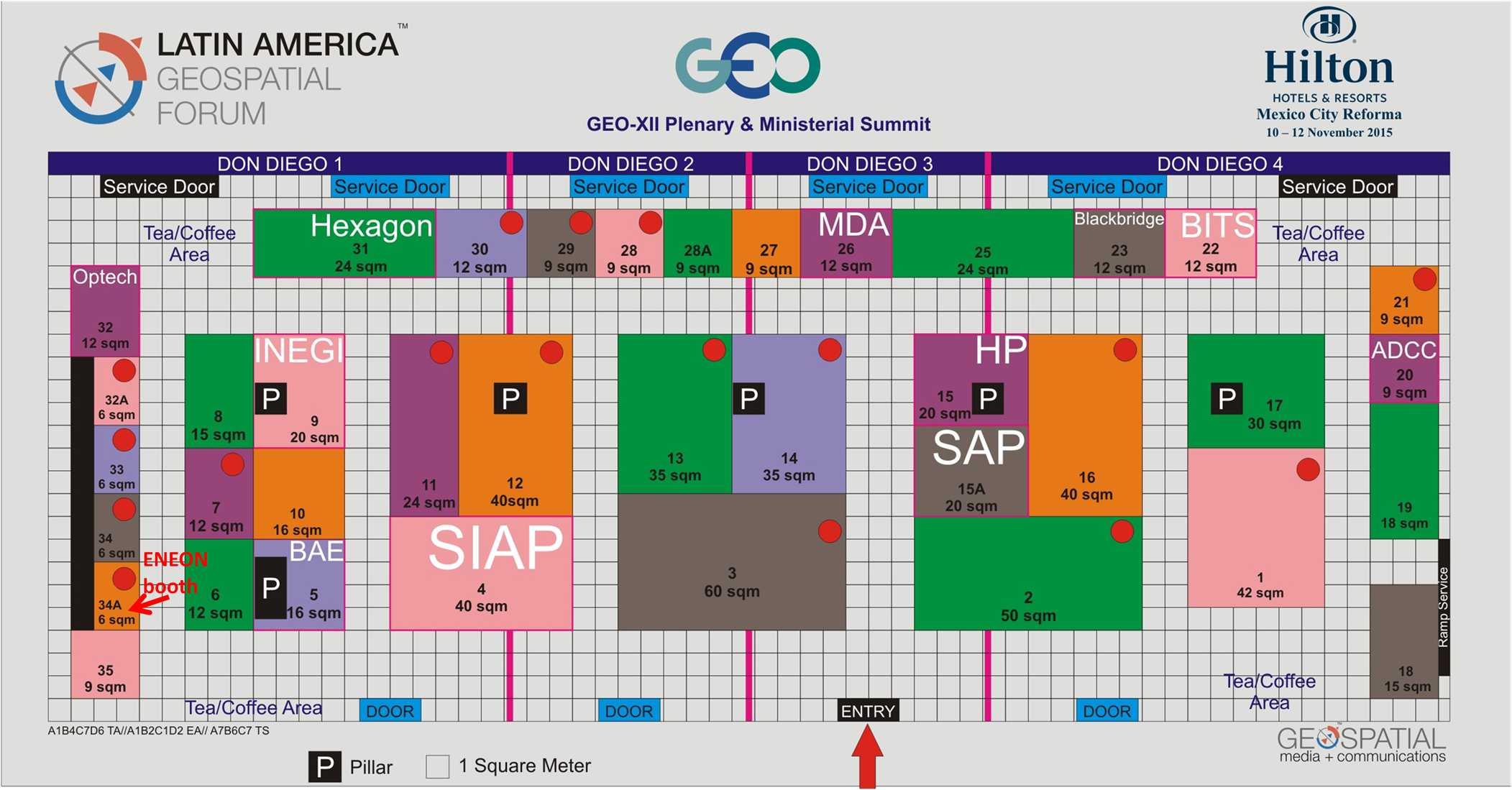
ENEON BOOTH
ENEON will have a booth in the exhibition (34A). Come and visit us!
----------------------------------------------------------
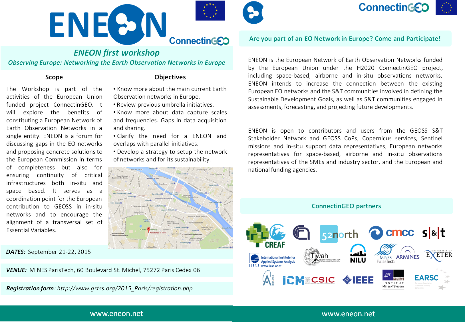
ENEON first workshop. Observing Europe: Networking the Earth Observation Networks in Europe
DATES: Paris | France | 21 – 22 September 2015
VENUE: MINES ParisTech 60 Bd. St Michel, 75272 Paris Cedex 06
The Workshop will explore the benefits and options of constituting a European Network of Earth observation Networks that encompasses current networks in Europe in single entity. The ENEON will be a forum for discussing gaps in the EO networks and proposing concrete solutions to the European Commission in terms of completeness but also for ensuring continuity of critical infrastructures both in-situ and space based. It will also serve as a coordination point for the European contribution to GEOSS in the matter of in-situ networks and to encourage the alignment of a transversal set Essential Variables GEO is currently advocating.
Objectives
- Know more about the main current Earth Observation networks in Europe.
- Review previous umbrella initiatives.
- Clearly define the goals, objectives, benefits and impacts.
- Develop a strategy to setup the network of networks.
- Consider the legal status of the network.
PROGRAMME & PRESENTATIONS
Monday, September 21, 2015
| 0830 - 0900 | Registration |
| 0900 - 0940 | Session 1: Welcome and Introduction (Chairs: Joan Masó and Thierry Ranchin) |
| 0900 - 0910 | Thiery Ranchin (MINES Paris Tech): Welcome and Opening Remarks (pptx) |
| 0910 - 0920 | Joan Masó and Ivette Serral (CREAF): The ConnectinGEO project (pptx) |
| 0920 - 0930 | Ian McCallum (IIASA): ENEON (pptx) |
| 0930 - 1050 | Session 2: Goals, objectives, benefits and impacts (Chairs: Ivette Serral, Hans-Peter Plag) |
| 0930 - 0950 | Barbara Ryan (GEO Secretariat): How ENEON should collaborate with and be included in GEO (pptx) |
| 0950 - 1010 | Michel Schouppe (EC): The European GEOSS context for ENEON (ppt) |
| 1010 - 1030 | Werner Kutsch (ENVRI+ Coordinator): The ENVRI+ Approach to networking (pptx) |
| 1030 - 1050 | Jan Hendrik Voet (IRCEL): The Copernicus cross-cutting in situ component (pptx) |
| 1050 - 1100 | Ivette Serral (CREAF) and Hans-Peter Plag (TIWAH): Workshop objectives and anticipated outcomes (pptx) |
| 1100 - 1125 | Coffee Break |
| 1125 - 1315 | Session 3: European Earth Observation Networks: Needs for coordination and collaboration regarding the detection of gaps and redundancies in GEOSS. (Chair: Joan Masó) |
| 1125 - 1150 | Werner Kutsch (ICOS): ICOS: Integrated Carbon Observation System (pptx) |
| 1150 - 1215 | J. Notholt (presented by Martine de Maziere): TCCON: Total Carbon Column Observing Network (pptx) |
| 1215 - 1240 | Martine de Maziere: NDACC: Network for the Detection of Atmospheric Composition Changes (pptx) |
| 1240 - 1310 | Geir Ole Braathen: How does the World Meteorological Organization manage and exploit its observational networks? (pptx) |
| 1310 - 1410 | Lunch |
| 1410 - 1540 | Session 3 continued (Chair: Martine de Maziere) |
| 1410 - 1440 | Stefano Nativi: GEOSS Infrastructure for Earth Observation Networks (pptx) |
| 1440 - 1505 | Simon Wilson: Arctic Monitoring and Assessment Programme (AMAP) (pptx) |
| 1505 - 1535 | Wolfgang Grabs: Hydrological networks (pptx) |
| 1535 - 1605 | Carine Bruyninx: EPN: EUREF Permanent Network and EUREF (pptx) |
| 1605 - 1625 | Coffee Break |
| 1625 - 1815 | Session 3 continued (Chair: Emili Garcia Ladona) |
| 1625 - 1645 | Eric Petermann: EUMETNET (pdf) |
| 1645 - 1715 | Begoña Perez: EuroGOOS (pptx) |
| 1715 - 1735 | Thomas Loubrieu: SEADATANET (Pan-European Infrastructure for Ocean and Marine Data Management) (pdf) and EUROARGO (pdf) |
| 1735 - 1755 | Wenche Aas: EMEP, ACTRIS (European Research Infrastructure for the observation of Aerosol, Clouds, and Trace gases) and atmospheric measurement activities of OSPARCOM and HELCOM (pptx) |
| 1755 - 1815 | Arne J. Berre: European Citizen Science Association (ECSA) (pptx) |
| 2000 - 2200 | Social Dinner (no host) |
Tuesday, September 22, 2015
| 0830 - 0900 | Registration |
| 0900 - 0945 | Session 4: Summary presentations from rapporteurs (Chairs: Ian McCallum, Hans-Peter Plag) |
| 0900 - 0915 | Rapporteur 1 (Ian McCallumn): Summary of key issues for sustainable EO networks in Europe (question block 1) (pptx) |
| 0915 - 0930 | Rapporteur 2 (Antonio Bombelli): Summary of data availability, sharing, and gaps (question block 2) (pptx) |
| 0930 - 0945 | Rapporteur 3 (Hans-Peter Plag): Summary of existing collaboration mechanisms, experience and lessons from the efforts (question block 3) (pdf) |
| 0945 - 1105 | Session 5: Engaging participation in ENEON: Lessons Learned (Chair: Palma Blonda) |
| 0945 - 1020 | Michael Mirtl: Long Term Ecological Research Network (LTER): overcoming fragmentation, lack of coordination, and duplication (pdf) |
| 1020 - 1100 | Lucy Bastin: Linking service infrastructure: Lessons learnt from DOPA: Digital Observatory for Protected Areas |
| 1100 - 1130 | Jan Hendrick Voet: EIONET: European Environment Information and Observation Network (pptx) |
| 1130 - 1145 | Coffee Break |
| 1145 - 1220 | Geoff Sawyer: Collaboration between Industry and European Networks (ppt) |
| 1220 - 1300 | Session 6: Toward enhanced coordination and collaboration (Chair: Hans-Peter Plag) |
| 1220 - 1245 | Hans-Peter Plag, Palma Blonda, Werner Kutsch, Jan Hendrick Voet, Geoff Sawyer: Panel statements on enhancing coordination and collaboration across disciplines and sectors |
| 1245 - 1315 | Hans-Peter Plag: The GEO Knowledge Base and Gap Analyses (pdf) |
| 1315 - 1400 | Lunch |
| 1400 - 1430 | Palma Blonda: Defining user needs and essential variables to support GEOSS objectives (pptx) |
| 1430 - 1600 | Session 7: Refine goals, objectives and benefits of ENEON (Chair: Joan Masó) |
| 1430 - 1440 | Hans-Peter Plag: Benefits of a European Earth Observation Network of Networks |
| 1440 - 1500 | Ian McCallum: Draft goals, objectives and benefits of ENEON |
| 1500 - 1530 | All (Moderator: Joan Masó): Round table: Goals, Objectives, and Benefits of ENEON |
| 1530 - 1535 | Moderator: Summary of Round Table outcomes |
| 1535 - 1610 | Coffee Break |
| 1610 - 1720 | Session 8: Organization and management of ENEON (Chairs: Hans-Peter Plag, Jay Pearlman) |
| 1610 - 1640 | Hans-Peter Plag: Draft organization, ToR, and membership of ENEON (pdf) |
| 1640 - 1700 | Paola Campus (remote presentation): Thoughts on a funding cycle for ENEON (pdf) |
| 1620 - 1630 | Joan Masó: Coordination of ENEON with similar initiatives, including ENVRI Plus (pptx) |
| 1630 - 1710 | All (Moderator: tbd): Discussion: ENEON organization, management and membership |
| 1710 - 1720 | Hans-Peter Plag: Summary and revised ToR for ENEON |
| 1720 - 1800 | Session 9: Summary Session: A roadmap for ENEON (Chairs: Ivette Serral, Hans-Peter Plag) |
| 1720 - 1735 | Ivette Serral: ENEON definition, criteria, processes (pptx) |
| 1735 - 1745 | Hans-Peter Plag: Steps towards the implementation of ENEON |
| 1745 - 1800 | Joan Masó and Thierry Ranchin: Concluding remarks |
MORE INFORMATION: http://eneonparis.connectingeo.net/
ORGANIZING COMMITTEE:
- CREAF. Joan Masó, Ivette Serral
- ARMINES. Lionel Menard
- TIWAH. Hans-Peter Plag
- IIASA. Ian McCallum.
- CMCC. Antonio Bombelli
- CNR-ISSIA. Palma Blonda
- IEEE. Jay Pearlman, Françoise Pearlman
SCIENTIFIC COMMITTEE:
- CISC. Emili García-Ladona
- BIRA-IASB. Martine De Maziere
- NILU. Kjetil Tørseth, Wenche As.
- ARMINES. Lionel Menard, Lucien Wald
- CMCC. Antonio Bombelli
click to get the pdf version
----------------------------------------------------------
Essential Variables for GEOSS. Towards a sustainability process for defining GEOSS EV
DATES: Bari | Italy | 11 – 12 June 2015
VENUE: Dipartimento Interateneo di Fisica, Via G. Amendola 173, 70126 Bari, Italy
The Workshop will review the work on essential variables (EVs) in all GEO Societal Benefit Areas (SBAs). The goal is to contribute to the formulation of lists of EVs required to populate the Socio-Economic and Environmental Information Needs Knowledge Base (SEE IN KB) and to quantify the metrics for selected communities, In GEO, some SBAs are currently discussing SBA-specific sets of EVs. The goal of the Workshop is to identify an integrated set of EVsbalanced between the different SBas that can support a priorization of EO networks.
Objectives
- Review the status of existing Essential Variables (EVs) in different communities/domains and the processes used to identify them.
- Clarify to what extent these EVs are validated and used.
- Develop consensus on a common process for the identification of EVs in support of the communities that are currently defining them.
- Attempt an integration of the different sets of EVs developed so far. A peer reviewed document on the EV status and definition process, and requirements will be produced.
PROGRAMME & PRESENTATIONS
Thursday, June 11, 2015
| 0830 - 0900 | Registration |
| 0900 - 1030 | Session 1: INTRODUCTION AND OBJECTIVES |
| 0900 - 0920 | Palma Blonda: Welcome and Opening Remarks (pptx) |
| 0920 - 0940 | Joan Masó and Ivette Serral: The ConnectinGEO project (pptx) |
| 0940 - 1000 | Hans-Peter Plag: EVs in the project and GEO Societal Benefits Areas (pptx) |
| 1000 - 1020 | Stefano Nativi: EVs and relations to the GEOSS Common Infrastructure (pptx) |
| 1020 - 1030 | Antonio Bombelli: Objectives of the Workshop and final document (pptx) |
| 1030 - 1100 | Coffee Break |
| 1100 - 1230 | Session 2: EVs FOR CLIMATE, CARBON CYCLE and OCEANS. Chair: A. Bombelli |
| 1100 - 1130 | H. Dolman: EVs for Climate and Carbon (pdf) |
| 1130 - 1200 | Iris Kriest: EVs for Oceans (pdf) |
| 1200 - 1230 | R. Pastres: The potential role of EV in the implementation MSFD and UNEP (pptx) |
| 1230 - 1300 | Greg Carmichael: Atmospheric composition requirements for various applications (pdf) |
| 1300 - 1400 | Lunch |
| 1400 - 1530 | Session 3: EVs FOR WATER and WEATHER. Chair: Hans-Peter Plag |
| 1400 - 1430 | U. Looser: EVs for river discharge (pptx) |
| 1430 - 1500 | Sushel Unninayar and Water Community: EVs for Water (pptx) |
| 1500 - 1530 | D. Richardson: EVs for Weather (pptx) |
| 1530 - 1600 | Coffee Break |
| 1600 - 1800 | Session 4: EVs for ENERY and DISASTERS. Chair: T. Ranchin |
| 1600 - 1630 | T. Ranchin: EVs for Energy (pptx) |
| 1630 - 1700 | Jane Rovins: EVs for Disasters (pptx) |
| 1700 - 1730 | Giuseppe Puglisi: Observation systems in the framework of the EPOS-IP project: the case of the volcanological community (pptx) |
| 1730 - 1800 | A. Monett: Chilean SDI integrating GEO network: interoperability challenges for supporting disaster management (pptx) |
| 2000 - 2200 | Social Dinner (no host) |
Friday, June 12, 2015
| 0830 - 0900 | Registration |
| 0900 - 1230 | Session 5: EVs FOR BIODIVERSITY (EBVs) AND ECOSYSTEMS (EEBs). Chair: Palma Blonda |
| 0900 - 0930 | J. Freyhof: Biodiversity: what EBVs are, why they are important, and what problem they solve (pptx) |
| 0930 - 1200 | Gary Geller: Biodiversity: the process of converging on them and state of art (pptx) |
| 1000 - 1030 | C. Hauser: Biodiversity: EBVs versus policies (pptx) |
| 1030 - 1100 | Coffee Break |
| 1100 - 1130 | N. Cordoba: Examples of candidate EBVs in Colombia (pptx) |
| 1130 - 1200 | A. Provenzale: Ecosystems (pdf) |
| 1200 - 1300 | Session 6: EVs FOR HELTH AND GLOBAL HUMAN SETTLEMENTS. Chair: H.-P. Plag |
| 1200 - 1230 | Simon Hales: EVs for Health (pptx) |
| 1230 - 1300 | Thomas Kemper: EVs for Human Settlements (pptx) |
| 1300 - 1400 | Lunch |
| 1400 - 1530 | Session 7: EVs for Agriculture. Chair: J. Maso |
| 1400 - 1430 | Ian Jarvis: Agriculture (ppt) |
| 1430 - 1500 | I. Mccallum: EVs for economic modeling (pptx) |
| 1500 - 1530 | All: Discussion |
| 1530 - 1600 | Coffee Break |
| 1600 - 1800 | Session 8: SUMMARY SESSION. Chair S. Nativi |
| 1600 - 1630 | Case studies (with links to GEO- AIP8): soil moisture map (pdf); habitat map. (pptx); Towards Web Model paradigm (pdf); Phylogentic diversity on WPS (pdf) |
| 1630 - 1645 | Stefano Nativi: Summary of Main Points Made (pptx) |
| 1645 - 1700 | Hans-Peter Plag: Summary of Responses to Questions (pptx) |
| 1700 - 1730 | All: Discussion |
| 1730 - 1800 | Palma Blonda and Antonio Bombelli: Recommendations and a time-line for the report (pptx) |
| 1800 | Joan Masó: Close of Workshop |
MORE INFORMATION: http://www.gstss.org/2015_Bari/index.php/
----------------------------------------------------------
ENEON in the General Assembly 2015
Vienna | Austria | 12 – 17 April 2015
- Launching the European Network of Earth Observation Networks (ENEON) (public)
Splinter Meeting SPM1.29
Mon, 13 Apr, 17:30–19:00 / Room R3
Through the European Union's ConnectinGEO project, the European Network of Earth Observation Networks (ENEON) is going to be launched, including space-based, airborne and in-situ observations networks with the goal of enhancing the use of Earth Observations for assessments, forecasts, and predictions of GEOSS SBA topics and Copernicus services. Anyone working with EO data (also in-situ) and willing to participate in the network is welcomed in this session, from existing European networks and Copernicus services providers to SMEs and the EO industry sector.Agenda
- ConnectinGEO presentation and context
- ENEON first idea (need to find EO gaps and priorities relation to GEOSS)
- Composition and benefits
- Discussion - Open Surface Solar Irradiance Observations - A Challenge
Lionel Menard, Daniel Nüst, Simon Jirka, Joan Masó, Thierry Ranchin, and Lucien Wald
ERE3.1 Orals
Fri, 17 Apr, Room R13. 10:30–10:45
Link to the abstract - EGU2015-6607 (*.pdf)
- Towards the creation of a European Network of Earth Observation Networks within GEO. The ConnectinGEO project
Joan Masó, Ivette Serral, Lionel Menard, Lucien Wald, Stefano Nativi, Hans-Peter Plag, Shelley Jules-Plag, Daniel Nüst, Simon Jirka, Jay Pearlman, and Martine De Maziere
ESSI2.1 Orals
Fri, 17 Apr, Room G1. 16:15–16:30
Link to the abstract - EGU2015-13792 (*.pdf)
----------------------------------------------------------
3rd GEOSS S&T Stakeholder Workshop: Navigating Sustainability on a Changing Planet
Norfolk, VA | USA | 23 – 25 March 2015
Registration
More information
WORKSHOP SCOPE AND OBJECTIVES
Our planet is rapidly changing and moving out of the Holocene. Navigating and managing the changes and maintaining a sustainable development is complex. We need to have goals and targets related to sustainable development, understand the limits of what is a safe and sustainable development, know the ongoing changes, and have foresight about the impact of our actions on the planet. The workshop aims at bringing together the science that links our goals with the “navigation tools,” that is, the indicators of change, and the Earth observations required to quantify these indicators.
A main outcome of the United Nations Conference on Sustainable Development (Rio+20), held in June 2012 in Rio de Janeiro, was the agreement by Member States to initiate a process to develop a set of “Sustainable Development Goals” (SDGs). Motivated by the partial success during the decade from 2005 to 2015 of achieving the “Millennium Development Goals” (MDGs), the SGDs would serve as the driver for progress towards the decade from 2015 to 2025. Since RIO+20, a number of groups have been active in developing the set of goals, with the Open Working Group on Sustainable Development (OWG) being central in the process. In July 2014, the OWG published its proposal for the SGDs (see the Outcome Documents of the 13th Session of the OWG), and in December 2014, the Secretary General added a synthesis report detailing The Road to Dignity. Both, for MDGs and SDGs, metrics that can measure progress towards the goals are important. The OWG has identified a set of indicators for the SDGs, which aim for consistency with the indicators used for the MDGs. These indicators are currently refined by technical teams. Many of these indicators are environment-related and require comprehensive Earth observations for a reliable quantification.
The concept of a safe operating space for humanity (SOSH) is central to sustainability. The global boundaries of the SOSH are partly known quantitatively, and partly blured, with potential thresholds still unknown. A better quantification of the boundaries and a monitoring of the state of the planet with respect to these boundaries depends on comprehensive Earth observations.
Major scientific organizations have identified grand research challenges that need to be addressed in order to provide the knowledge needed to make progress towards global sustainability. The required research also depends on a comprehensive and accessible Earth observation database. Research innovations are needed at many scales to address the grand challenges and to make progress towards the societal goals.
The Group on Earth Observations (GEO) is implemented the Global Earth Observation System of Systems (GEOSS) with the goal to improve access to, and the use of, Earth observations for a broad range of stakeholders. The 10 Year Implementation Plan for GEOSS endorsed by a Ministerial Summit in 2005 states “GEOSS is a step toward addressing the challenges articulated by United Nations Millennium Declaration and the 2002 World Summit on Sustainable Development, including the achievement of the Millennium Development Goals. GEOSS will also further the implementation of international environmental treaty obligations.” The recent Ministerial Summit on Earth Observation held in January 2014 in Geneva (see meeting documents) underlined the importance of the SGDs and of GEO focusing the development of GEOSS on the information needs that arise from humanity's quest for the SGDs.
The Implementation Plan Working Group (IPWG) initiated during the Ministerial Summit in 2014 with the mandate to draft the next 10 Year Implementation Plan for GEOSS has provided a first report summarizing the first “reflective phase” of the IPWG and laying out the scheme for the further development of GEOSS. At the XI GEO Plenary, the IPWG provided a draft Strategic Plan. The workshop will build on these reports and discuss the science and metric needed to achieve the goals indicated in these report.
With this in mind, the 3rd GEOSS S&T Stakeholder Workshop will focus on the knowledge needs of the global and national decision makers to enable progress towards global sustainability on a changing planet. The workshop will use the priorities of the discusion on the SGDs, the preliminary indicators, the grand challenges, and the global boundaries of the SOSH as a starting point in the discussion of the science of sustainability indicators with the goal to derive a comprehensive sustainability metrics. The workshop will address to what extent the current and planned Earth observation systems would allow a quantification of the indicators comprising this metrics.
Outcomes of the workshop will include a refined set of global sustainability indicators, the essential variables required to quantify these indicators, and an assessment of the capability of current and future Earth observation systems to provide observations of these essential variable with sufficient spatial and temporal resolution, accuracy, and latency.
Scientists and researchers engaged in environmental research supporting the current MDGs and the future SDGs and addressing the grand challenges are key stakeholders of GEOSS. Aligning the governing strategy for the implementation of GEOSS to the needs of these stakeholders has a high priority for GEO. The workshop will review the support of GEOSS for research on global sustainability and give guidance on how to improve this support.
----------------------------------------------------------
4th GEOSS S&T Stakeholder Workshop: Concepts, Technologies, Systems and Users of the Next GEOSS
Norfolk, VA | USA | 24 – 26 March 2015
Registration
More information
WORKSHOP SCOPE AND OBJECTIVES
The on-going evolution in the modus operandi of doing research and organizing science is largely driven by the many technological and information revolutions that characterizing the present digital era. Earth system scientists need to use and integrate very heterogeneous data and information characterizing various fields of academic study to understand the Earth as a system. Besides data diversity, data volume is dramatically increasing due the new and powerful technologies made available to acquire and share data and information. Advanced remote sensing technologies brought the challenge of data deluge for satellite data analysis and interpretation. Drones encapsulate the logic of (low cost) distributed, ubiquitous monitoring information capture. The convergence of wireless technologies, micro-electromechanical systems and the Internet is providing objects, animals and people with the ability to transfer data over a network without requiring human-to-human or human-to-computer interaction.
The open data revolution is increasingly affecting also digital models and processing algorithms made more and more accessible and interoperable on Internet. GEOSS Users (and their Web applications) need to know more about how to effectively discover and use this huge amount of heterogeneous data and the increasing number of processing services and digital models. There exists a clear need to define information in terms of data, knowledge in terms of information, and decision-support (i.e. wisdom) in terms of knowledge: the DIKW paradigm.
The 4th GEOSS S&T Stakeholder Workshop will focus on the scope of the future GEOSS and the concepts and technologies that can support a future-oriented “system of systems” providing observations and practice-relevant knowledge to a wide range of users. Information and knowledge systems are challenged by rapidly developing knowledge needs on the one side and an equally rapid development in (big) data availability not only from traditional sensors but also from a variety of human sensors, the developing Internet of Things (IoT) and Internet of Everything (IoE) scenarios, and the output of increasingly more advanced models. Cloud computing provides any public and private organization with the ability to use data and applications over the Internet instead of hosting, storing, or processing them on locally managed hardware.
In such a fast moving technological and information environment, GEOSS (and in particular its common infrastructure and information system) must be flexible to leverage a never-ending technological revolution. To reinforce GEOSS role and use, anticipating the next revolution is important.
GEOSS (and in particular its common infrastructure and information system) should apply the DIKW patterns and create knowledge; this requires an innovative sustainability and economic paradigm. Public-private-partnerships (PPP) may be considered for that.
Outcomes of the workshop will include position papers on various aspects of the future GEOSS, including: the integration of different sensor networks, the handling of the emerging “data super nova”, data patterns recognition to generate information, and principles recognition to generate knowledge.
Participants in the workshop will include technology developers; experts in data management, integration, and analysis; developers of knowledge systems and concepts for the linkage between decision making and knowledge; and user representatives.